Finches in Florida
4 species of finches have a mapped range in Florida. The most widespread is the American Goldfinch, mapped across all of the state.
The most restricted is the House Finch, mapped in 22% of the state.
The heaviest is the Purple Finch, at 0.8 oz (23 g); the lightest is the Pine Siskin, at 0.4 oz (13 g).
Of these, 1 are mapped year-round and 3 in winter only.
The most species are mapped in Washington County (4); the fewest in Broward County (1).
Open-licence records in the state that carry a month (1,249 of them) peak in May and are fewest in September.
The most often recorded is the House Finch, with 995 open-licence records in the state.
- American Goldfinch
- Pine Siskin
- Purple Finch
- House Finch
| Species | Size | Share of Florida | Active | Records | |
|---|---|---|---|---|---|
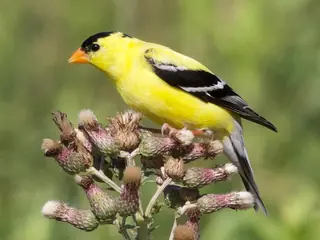 | American Goldfinch winter Spinus tristis Fringillidae | 0.5 oz (13 g) | all | day | 332 |
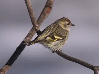 | Pine Siskin winter Spinus pinus Fringillidae | 0.4 oz (13 g) | 59% | day | 34 |
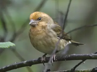 | Purple Finch winter Haemorhous purpureus Fringillidae | 0.8 oz (23 g) | 48% | day | 64 |
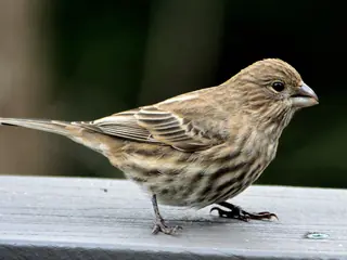 | House Finch Haemorhous mexicanus Fringillidae | 0.8 oz (21 g) | 22% | day | 995 |
Share of Florida is the part of the state inside the species' USGS range map. Size is the largest on record where the source gives a maximum, otherwise a typical adult. Records are open-licence observations and specimens in the state, with eBird left out; a blank means none were counted, not that the species is absent. "Recorded" marks a species with no USGS range here that open records place in the state (ten or more, in three or more years).
More Florida lists
Other groups in Florida
Finches in nearby states
Sources
- AVONET: morphological ecological and geographical data for all birds. CC BY 4.0. Read 2026-11-15.
- EltonTraits 1.0. CC0. Read 2026-11-15.
- GBIF Backbone Taxonomy. CC BY 4.0. Read 2026-11-15.
- GBIF occurrence records under CC0 and CC BY 4.0. CC0 and CC BY 4.0 per record. Read 2026-11-16.
- US Census Bureau cartographic boundary files 2023. Public domain (US Census Bureau). Read 2026-11-15.
- USGS GAP 12-digit hydrologic unit range units. Public domain (USGS). Read 2026-11-15.
- USGS Gap Analysis Project Species Range Maps CONUS_2001. Public domain (USGS). Read 2026-11-15.
- iNaturalist photographs under CC0 and CC BY. CC0 and CC BY per photograph. Read 2026-11-15.
How each figure is derived is set out on the methods page.