Foxes in New Mexico
4 species of foxes have a mapped range in New Mexico. The most widespread is the Gray Fox, mapped across all of the state.
The most restricted is the Swift Fox, mapped in 29% of the state.
The longest is the Gray Fox, at 2.2 ft (671 mm); the shortest is the Kit Fox, at 20 in (510 mm).
The most species are mapped in Torrance County (4); the fewest in Catron County (2).
Open-licence records in the state that carry a month (1,399 of them) peak in July and are fewest in August.
The most often recorded is the Gray Fox, with 708 open-licence records in the state.
- Gray Fox
- Red Fox
- Kit Fox
- Swift Fox
| Species | Size | Share of New Mexico | Active | Records | |
|---|---|---|---|---|---|
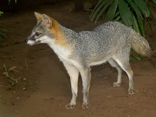 | Gray Fox Urocyon cinereoargenteus Canidae | 2.2 ft (671 mm) body | all | night | 708 |
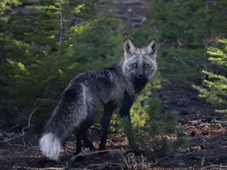 | Red Fox Vulpes vulpes Canidae | 2.1 ft (630 mm) body | 81% | night | 107 |
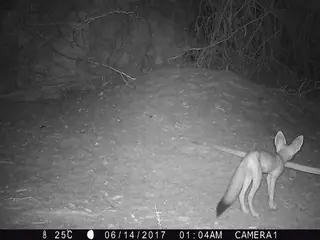 | Kit Fox Vulpes macrotis Canidae | 20 in (510 mm) body | 65% | night | 208 |
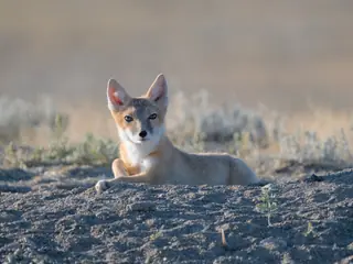 | Swift Fox Vulpes velox Canidae | 20 in (514 mm) body | 29% | night | 613 |
Share of New Mexico is the part of the state inside the species' USGS range map. Size is the largest on record where the source gives a maximum, otherwise a typical adult. Records are open-licence observations and specimens in the state; a blank means none were counted, not that the species is absent. "Recorded" marks a species with no USGS range here that open records place in the state (ten or more, in three or more years).
More New Mexico lists
Other groups in New Mexico
Foxes in nearby states
Sources
- COMBINE: a coalesced mammal database of intrinsic and extrinsic traits. CC BY 4.0. Read 2026-11-15.
- EltonTraits 1.0. CC0. Read 2026-11-15.
- GBIF Backbone Taxonomy. CC BY 4.0. Read 2026-11-15.
- GBIF occurrence records under CC0 and CC BY 4.0. CC0 and CC BY 4.0 per record. Read 2026-11-16.
- US Census Bureau cartographic boundary files 2023. Public domain (US Census Bureau). Read 2026-11-15.
- USGS GAP 12-digit hydrologic unit range units. Public domain (USGS). Read 2026-11-15.
- USGS Gap Analysis Project Species Range Maps CONUS_2001. Public domain (USGS). Read 2026-11-15.
- iNaturalist photographs under CC0 and CC BY. CC0 and CC BY per photograph. Read 2026-11-15.
How each figure is derived is set out on the methods page.