White-throated Swift
Aeronautes saxatalis
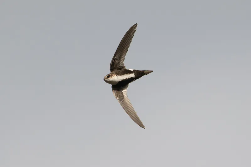
The White-throated Swift (Aeronautes saxatalis) is a bird in the family Apodidae. USGS maps its range in 14 of the lower 48 states, and in 4 of them it covers the whole state. Adults weigh about 1.1 oz (32 g).
Across most of its mapped range it is a summer bird.
It is active by day. It eats mainly insects and other invertebrates. AVONET classes it as a species that does not migrate.
The USGS habitat model maps it across 295 land-cover types. The model places it no higher than 3,962 m (13,000 ft).
Open-licence records from the lower 48 (3,218 of them) peak in June and are fewest in November. A typical clutch is about 4.3. The longest recorded lifespan is 10 years.
Where the White-throated Swift lives
| State | Share of state | Counties | Open records | Peak month |
|---|---|---|---|---|
| Arizona | all | 15 of 15 | 334 | June |
| Utah summer | all | 29 of 29 | 205 | May |
| Wyoming summer | all | 23 of 23 | 29 | |
| Nevada summer | all | 17 of 17 | 34 | May |
| Idaho summer | 99% | 44 of 44 | 20 | |
| New Mexico summer | 79% | 28 of 33 | 106 | June |
| California | 76% | 54 of 58 | 2,203 | June |
| Montana summer | 66% | 43 of 56 | 52 | May |
| Colorado summer | 64% | 47 of 64 | 252 | June |
| Oregon summer | 60% | 17 of 36 | 9 | |
| Washington summer | 26% | 18 of 39 | 113 | June |
| Texas | 11% | 11 of 254 | 59 | May |
| South Dakota summer | 9% | 7 of 66 | 27 | |
| Nebraska summer | 5% | 5 of 93 | 29 |
Share of state is the part of each state inside the range map. Counties counts those with at least a tenth of their area in range. A state link opens that state's full list.
When it is recorded
Sources
- AVONET: morphological ecological and geographical data for all birds. CC BY 4.0. Read 2026-11-15.
- Amniote life-history database. CC0. Read 2026-11-15.
- EltonTraits 1.0. CC0. Read 2026-11-15.
- GBIF Backbone Taxonomy. CC BY 4.0. Read 2026-11-15.
- GBIF occurrence records under CC0 and CC BY 4.0. CC0 and CC BY 4.0 per record. Read 2026-11-15.
- Integrated Taxonomic Information System. CC0. Read 2026-11-15.
- US Census Bureau cartographic boundary files 2023. Public domain (US Census Bureau). Read 2026-11-15.
- USGS GAP 12-digit hydrologic unit range units. Public domain (USGS). Read 2026-11-15.
- USGS Gap Analysis Project Species Habitat Maps CONUS_2001 (model parameters). Public domain (USGS). Read 2026-11-15.
- USGS Gap Analysis Project Species Range Maps CONUS_2001. Public domain (USGS). Read 2026-11-15.
- iNaturalist photographs under CC0 and CC BY. CC0 and CC BY per photograph. Read 2026-11-15.
How each figure is derived is set out on the methods page.